Showing posts with label C and O canal. Show all posts

Sunday, June 9, 2024

Water is back in the canal

Top of Lock 22 (Pennyfield Lock)

In mid May I was at Great Falls along the C and O canal and noticed that the canal had been re-watered there.  I didn't know how far north they had put water back in the canal.

The canal hasn't had water in it for a few years. I actually don't remember the last time I saw it with more than a trickle of water.  The park service was replacing the locks and doing other canal maintenance all last year, I even posted about it once last year.  In 2018 and 2020 I posted about the canal at Great Falls tavern, but I think some parts of the canal to the north had water at the time.

The canal is at least mostly full between Great Falls and Lock 23 Violett's Lock. That is also the location of Inlet Lock 2, and the canal hasn't had water in it above that spot in my memory.  The water does look low, Above Swains lock it could use another foot or two of water. I'm not sure if it is still in the process of being filled or if this is the new normal.  Some spots, mostly where creeks flow into the canal are shallow enough that you can see the running water.

Islands of plants growing in the water of the canal.

Muskrat swimming in the canal

This is the first time I have ever seen a muskrat in the wild. They look alot like narrow-tailed beavers. This one totally ignored my while it swam, dove, and nibbled on grass.

 I'll also note that I drove on Canal Road on Sunday and the part of the canal near Georgetown still has no water in it.


Wednesday, December 20, 2023

Seen at Great Falls, MD


High above the C & O canal near Great Falls Tavern is this stone.  Two peoples names are carved into it. C. J. Isackson and Olga Anderson.  Along with that is carved N.D.  It was obviously inscribed long ago because the lichens growing on the rock also grow into the engraved initials. The sun is at a low angle this time of year which really makes the letters stand out.


Sunday, July 9, 2023

Looking down on Great Falls

Most of the time, when I go to Great Falls, I either walk or bike on the C & O Canal, or I go out to Olmstead Island, or I do the Billy Goat Trail.  All fun things to do and experience.  There is, however, more to do there.  There is a whole network of trails on the far side of the canal from the river, and one of them leads up to this overlook where you can get a nice view of the area (though your view is punctuated by trees).
 

Saturday, May 6, 2023

Construction on the C & O Canal near Great Falls


 Right now there is an ongoing construction project on the C & O Canal just north of Great Falls Tavern, I don't think they will be working weekends, but during the week there could be an impact.  I saw them working on Friday, but they were done for the day by 3:30.


They have built a gravel bridge across the canal to provide access to the towpath side, and in places, the towpath is a bit torn up from heavy equipment driving on it, but it is still easily passible.


Construction notice

More information is on a sign at the construction site: "Contractors and the U.S. Army Corps of Engineers are working to remove sediment from select locations along the canal in the vicinity of Great Falla, resurfacing the towpath from Lock 21-23, and removal of debrise from the canal between Lock 20-23.  During these projects, the towpath will intermittently be closed for up to 1-hour to facilitate construction access."


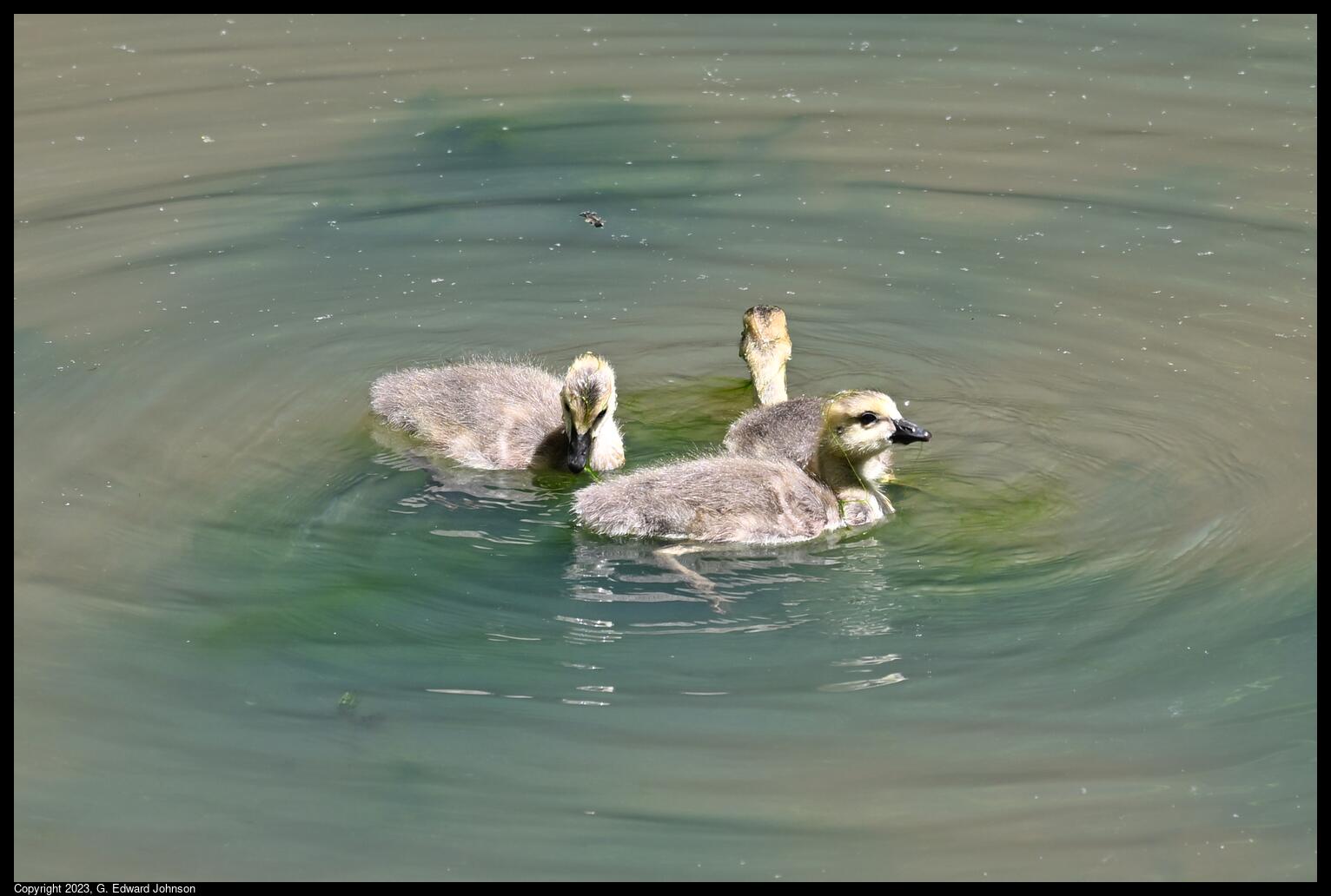
Also, it is gosling season. There were a number of Canada Goose families with young goslings on the canal above Great Falls.


Sunday, August 16, 2020

Go Visit: Harpers Ferry


Harpers Ferry lies at the confluence of the Potomac and Shenandoah rivers where Maryland, Virginia, and West Virginia meet. The town is in West Virginia and the lower part of the town is within the US Park Service run Harpers Ferry National Historic Park. 


You have probably heard of Harpers Ferry when you learned history in school.  It is the site of the abolitionist John Brown's raid on the US arsenal there. Brown attacked and captured several buildings; hoping to secure the weapons depot and arm the slaves, starting a revolt across the South. The raid ultimately failed when the US army sent an expedition commanded by Lieutenant Colonel Robert E. Lee (who would later become a general in the Confederate army) stormed the fire house where Brown and his men had taken refuge.

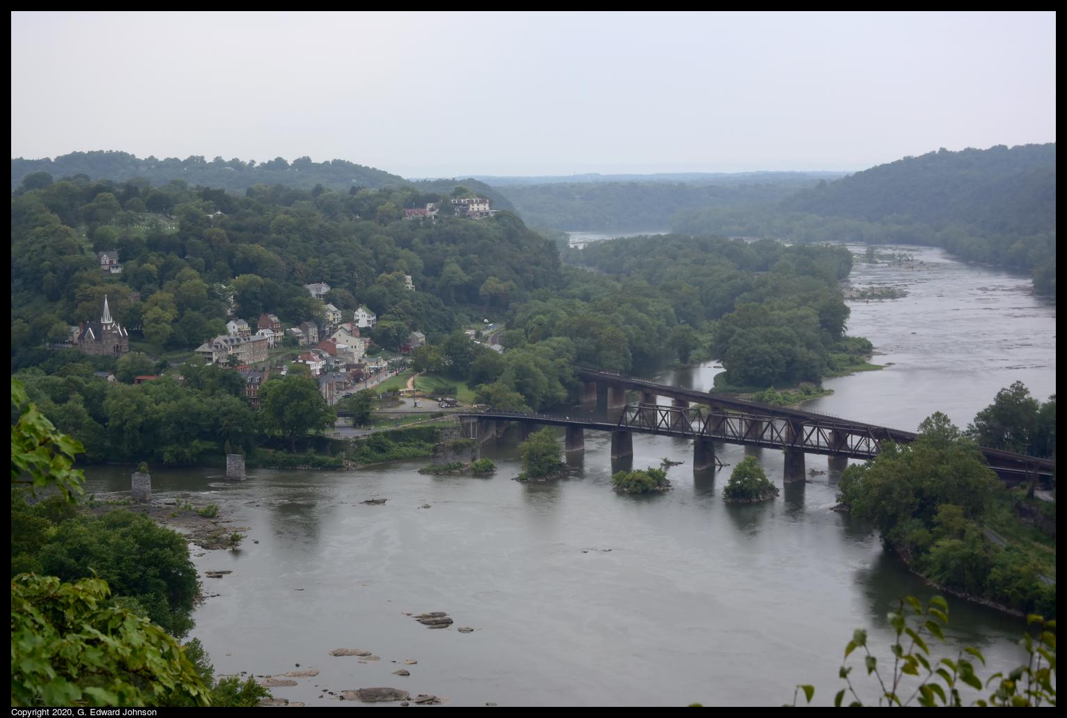
In addition to the downtown area, there are a number of hiking trails and beautiul sights to see.  There are two railroad bridges that cross the Potomac here as well as the piers of a couple of older bridges.  This one was built in 1894 and carries the CSX Shenandoah Subdivision line toward Winchester Virginia. The other bridge is just upstream was built in 1930 and caries the CSX Cumberland Subdivision line to Martinsburg, WV.

The bridge also carries the Appalachian Trail across the Potomac River.  This crossing was closed in late 2019 because of a train derailment, but the damage was fixed and the trail reopened in early July of this year.

A popular hike is to start in downtowm Harpers Ferry, cross the Potomac on the Appalachian Trail, travel north on the C & O canal a short distance, then take the Maryland Heights trail up to an overlook with a stunning view of Harpers Ferry and the rivers.

Here's the view of Harpers Ferry, the two railroad bridges, and the confluence of the Shenendoah River (top) and the Potomac River (bottom).  You can see piers from older bridges crossing the Potomac just to the left of the railroad bridges, and piers from a bridge that crossed the Shenandoah just before the confluence.


The C & O canal also runs along the Maryland side of the Potomac River.  The canal doesn't have water in it but the tow path is well maintained and is a popular place for hiking and biking. Here we are looking down at the bright ribbon of the C & O canal towpath and the Potomac River.  As seen from Maryland Heights, a large rock outcropping that overlooks Harpers Ferry, WV.

 Another hike you can do is to cross the Shenandoah River on the US Route 340 bridge (which is also used by the Appalachian Trail, so there is a separated walkway), follow the trail up the mountain then take a left on the Loudoun Heights overlook trail.  This takes you to an overlook where you can see Harpers Ferry from just below the confluence of the Shenandoah and Potomac rivers.


Friday, July 10, 2020

Go Visit: Monocacy Aquaduct

 The Monocacy Aqueduct is where the C & O Canal crosses the Monocacy River.  The aqueduct has been restored and you can walk or bike across it.  Right near the parking lot is a large field which slopes gently down to the Monocacy river.  People are often fishing on the river bank.  There is also a boat dock nearby that you can launch small boats from.

 In the early morning sun shines brightly on the arches of the aqueduct.  The aqueduct reflects on the still Monocacy river.

 On the aqueduct looking towards the parking area.  The tow path runs on top of the right wall.  You can also bike or walk down the canal bed.  You don't get good views, but it is a lot smoother.  The tow path in this area is made of compress stone dust, it is smooth and easy to ride a bike on.

 This is at the bottom of the field, the Monocacy aqueduct crosses over the Monocacy river.  During the Civil War, the lock keeper from nearby lock 27, Thomas Walter, convinced confederate general D. H. Hill not to destroy the aqueduct but to instead breach the earthen banks of the canal.

 The Monocacy river as seen from the aqueduct.  The water is smooth and has a light brown color

Less than three quarters of a mile south (turn left on the tow path from the parking lot) of Monocacy Aquaduct is Lock 27 on the C & O Canal.  The lock keepers house is still there and there is a bridge across the lock so you can see it from the other side.  It is a pleasant walk down a smooth towpath with trees shading you the entire way.

If you continue south past Lock 27 you will get to Pepco's Dickerson Generating Station.  There is a constant noise coming from the plant.  Past it, the river is very close to the canal edge and there aren't as many trees shading you.  Whites Ford and White's Ferry are even further south.  From the aqueduct to Whites Ferry is 6.5 miles, a long walk but not a bad bike ride.


There is a small parking lot, but on busy weekend days it fills up early and people park along the road.

Wednesday, July 1, 2020

Go Visit: Whites Ferry

 There is still an operating ferry in the DC area.  Whites Ferry crosses the Potomac near Poolesville in Maryland and Leeseburg in Virginia.  You can take your car across it.  You pay when you get on the barge, no need to pay in advance.  If you have never been on a ferry, it is a fun trip.  I used to commute from Maryland to Dulles, VA and would take the trip twice a day, it was much more enjoyable than being stuck in traffic on the American Legion Bridge.

 Here is the store and grill attached to the ferry, I'm not sure if it is open right now due to CoViD-19

Whites Ferry is also a great place to start a walk or bike ride along the C and O canal.  The canal doesn't have water in this area, but the tow path is in good condition and made of compacted crushed stone dust.  The canal runs all the way from Georgetown in Washington DC to Cumberland, MD.  A total of 186 miles.

Here is the remains of a tunnel that took a creek under the canal, and behind it, a bridge that used to take vehicles over the canal to the ferry.

 Looking south down the canal.  On the right is the tow path, on the left, between the trees is river road.

River Road goes all the way to Whites Ferry, It is a narrow gravel road by the end.

Friday, January 3, 2020

The tree stump is grinning at me


I went for a hike at Great Falls earlier this year and found this tree stump smiling at me.  Or maybe it isn't really smiling, it could be blood driping down its face.  The mouth is actually a shadow cast on the stump from the short tree at the right of the picture.

Wednesday, January 1, 2020

Fixing the locks on the C&O Canal


The lock gates on the C and O Canal at Great Falls Tavern have been in pretty bad shape for a while.  That is changing however.  I went there today and locks 16 and 17 have been rebuilt and Lock 18 is in progress.  The towpath is closed between locks 17 and 18, but there is a temporary path on the far side of the canal, so no need to stay away.


There still isn't water in the canal because they are currently working on Lock 19.  Lots of sediment has built up in this section of the canal and it looks like they will dig that out as well.


We've had nice weather for the past week or two and I'm glad I've gotten out to enjoy it.  Hopefully you have been able to spend time outside too.


Monday, May 28, 2018

Construction on the canal at Great Falls Tavern

There is ongoing construction work fixing up the canal between locks 5 and 22.  I was at Great Falls this weekend and saw what work is being done there. The entire project started last winter and will continue through next spring, however I don't know when the work around the tavern will be done.  Even with the construction, the area is still open and usable, so don't let this keep you from going.


There is a structure here where water can be diverted from the canal back into the Potomac river, they have totally torn it out and are rebuilding it.

Looking south at the lock by Great Falls Tavern.  The black plastic pipe carries the water in the canal past the construction.

Looking north, you can see the gravel dam at the top of the picture which the construction vehicles use to cross onto the tow path.  Peyond that you can barly see the white of the dam that actually blocks the water and that visitors can use to cross back onto the tow path.

South of the construction zone, this is where you have to leave the tow path and cross over the bridge to continue north along the canal.

Unrelated to the construction, but important if you plan to visit in the next few days, the Billy Goat trail is closed because of high water.  Olmstead Island is open and is a great place to see the river during high water.

Saturday, October 26, 2013

C & O canal at Edward's Ferry

The weather is cooling off, but there is still time to enjoy the outdoors. On Thursday I decided to walk along the C & O Canal and see how the leaves were changing.
I went to Edward's Ferry, it is about 45 minutes from Bethesda, MD, but isn't nearly as crowded as the canal around Great Falls or Swain's lock can be.  Edward's ferry is right at lock 25.  The lockhouse has been maintained and you can even rent it for the night.
There used to be a small community at the ferry, there isn't much left, but this building has been partially re-built.  I went here a number of years ago and at the time, this was two-story ruins.  It is hard to say how much of the brickwork is original and how much is rebuilt, but I think a lot of it is rebuilt.
If you walk north along the canal for about a mile you get to a place where the canal went over a stream called Broad Run.  The stone work is all still here, and the creek flows across the canal and under the tow path.
Here is how the trail looks north of Edward's Ferry., lots of greens and yellows this time of year.
Just a little south of Edward's ferry is what is left of the Goose Creek river lock (Goose Creek in Virginia enters the Potomac on the other side of the river). This is actually a combination of two locks, this picture was taken from the lower one looking up at the upper one.
Here's is the Potomac river looking north. If you look closely you may be able to see the boat launch ramp at Edward's ferry on the right.
Another view of the river lock right where it connects to the river.
Just a little further south is the Chisel Branch hiker/biker campsite.  It has a picnic table, grill, and port-a-potty.
While on my walk I saw a nice deer crossing the trail and this red fox.  He was a bit suspicious of me and kept his distance.
I also drove to the next access spot at Sycamore Landing.  There is a soybean field right next to the parking lot, and of course, miles of towpath to walk on.